Monday, December 25, 2006

Week 39 (16th - 24th December)

Quagi Beach – with its campsite comprised of little enclaves amongst thick coastal bush dominated by banksias 100m from a small cove proved to be an idyllic spot to hole up in for a couple of days. Gentle sea breezes to keep us cool while beach-combing, sunbathing and paddling in the chilly waves kept us occupied for most of the first day. More of the same the following day, or so we thought, when we wandered down after breakfast and within an hour realised that we were in for a hot day. George took a quick dip and on our return to the caravan discovered all the keys had gone swimming too! Back to the beach we went and this time round he luckily found them in a metre of water. As the day wore on the temperature soared to 44°C and blistering hot winds developed. Without power we had no air conditioning to save us this time round. Perspiration poured off us inside Getaway, even our spectacles scorched us and the binding of our paperback books just came apart as the glue dried out. We couldn’t keep cool, and sponging ourselves down brought little relief. Eventually, heat madness drove us over the burning sand into the sea. The relief was immeasurable and we wallowed in the waves for a good part of the afternoon. Interestingly, a team of botanists arrived back at their campsite after a driving ban had been issued due to the risk of their vehicle catching fire while out in the field!
Bees were also feeling the heat as by late afternoon the bucket that catches our waste water from the kitchen sink had attracted what appeared to be the entire hive! Feeling rather like Keith and Colleen in their film Snake Killers of the Kalahari when the wet towels they used to keep themselves cool attracted swarms of bees, our wet costumes had a similar effect. As for the bush-flies – they were out in full force using us to keep out of the hot wind. Turning away from the wind only made it worse because then they would try to keep cool up our noses and behind our “sunnies” and we didn’t dare speak! Fortunately by late evening cloud had moved in and the hot winds disappeared but the flies and bees continued to hum around Getaway until night fell around eight o’clock.

Quagi Beach

The bees woke us early next morning and overcast skies gave lie to yesterday’s heat. A good day to travel and we moved on to Munglinup Beach. Just as the Zulus use Kwa meaning “place of” so the Aborigines attach “… up”. Consequently, as we travel through this part of Western Australia many town names end in “.. up” derived from Aboriginal names. Like Quagi Beach campsite, Munglinup Beach site was also Shire run. Graders were re-surfacing the dirt road in, in readiness for Christmas and we were the first to travel the newly smoothed road and found we had the camp to ourselves. The dense cloud cover stayed with us for the rest of the day turning our turquoise blue seas into a mixture of deep green tones. The steep profile of the beach made walking difficult as we made our way to the mouth of the Munglinup Inlet that we followed a quad track along the crest of the fore-dunes and were dismayed to discover a hidden labyrinth of “quad heaven” with little regard to the sensitivity of the environment.

The dawn of another grey day pushed us on to sunnier climes, not that we counted on that from our past experiences of this region. The Southern Ocean is renowned for the cold fronts that it generates across here.
Approaching Jerramungup the first sounds of insects ricocheting off the windscreen brought a smile to George’s face. Locusts? News headlines in Esperance had advised that a locust plague in the Mt Barker district was likely to sweep through the wheat belt. We’d pricked up our ears as we were booked into Mt Barker after Christmas. Before long we were in no doubt as we passed through blitzes of flying grasshoppers. Birds of all sizes were dicing with death as they feasted on the ‘hoppers carpeting the road. We continued to encounter swarms right up to our bush camp in the Pallinup River Nature Reserve where, surprisingly, they weren’t at all intrusive. We did, however, get whiffs of something smelly, perhaps a dead kangaroo? Our evening walk took us down to the river and the closer we got the stronger it became. We were appalled to find our “smell” was emanating from stagnant pools within the rocky bed of the river. Lea felt quite overwhelmed by the noxiousness of it all and even more horrified when George pointed out that the gas bubbling up from the floor of the pools was hydrogen sulphide. A few months back we’d watched an ABC documentary on a new theory regarding an unsolved double murder in the 1960’s where a couple involved in an elicit affair had been found dead on the edge of a river. Nothing could account for their death at the time until all these years later a scientist proposed that they may have been overcome by the an up-welling of hydrogen sulphide from the polluted sediments of the river. To avoid having the same fate befall us we moved out of the designated camping area to a site downstream of the bridge where the greater volume of water had no smell. Nevertheless, this river has a severe water quality problem. The bridge carrying the main road turned out to be of interest while we were down in the odorous part of the river bed as it had been built entirely of timber, certainly not apparent when we had crossed it.

It began raining during the night and was still drizzling when we got up and left for Cape Riche campground, the access road giving us 18km of red, sticky mud to travel on. Two wet looking kangaroos met us at the gate and virtually led us into a lovely site overlooking a wide bay with the sound of waves whooshing on the beach just below us. After a warming cup of tea we donned our jerseys and walked westward along Shed beach, with sand so fine that it squeaked underfoot, onto a rocky headland where we were delighted to find a kangaroo and her big joey. From there we had a good view of Cheyne Island, a nature reserve that lies 1km offshore and is home to Fairy Penguins.

Western Grey Kangaroo on rocks at Cape Riche campground

Following a fisherman’s track through the heath we were bombarded by locusts flitting across our pathway. So they had reached here too! The next beach, Home beach, took us round to the Cheyne lagoon and up into rolling heath-covered hills which in the misty, damp weather seemed reminiscent of Scotland. Perhaps the Scottish couple, George and Grace Cheyne felt this affinity when they established a trading post here in 1839.

Grey weather followed us into our second day here. Just as we set off for an easterly walk along Schooner Beach a small group of kangaroos feeding on the coastal verge between our caravan and the beach, held us up as we curiously observed each other mere metres apart. Best was the little joey’s face and ungainly legs sticking out of his mothers’ pouch. We had to clamber over brightly coloured orangey-yellow rocks to get onto Schooner beach, a conservative 3km stretch of flat beach backed by sheer sandstone cliffs. There we discovered a lemming-like situation ... within the flotsam of the high water mark were thousands upon thousands of drowned locusts. This got us thinking of the food chain frenzy that has resulted from this plague and whether it spills over into the marine environment.

Locusts washed up on HWM at Schooner beach

On our return we had a break in the skies. Our green seas turned back to their beautiful mottled blues and we were able to enjoy the beach until the ultra-violet rays sent us back to the cover of Getaway.

On leaving Cape Riche we decided it had been our most aesthetically satisfying campground and if it hadn’t been for the restriction on dogs would have been perfect for our Christmas break. Confusingly, Cheyne’s Beach where we were to spend Christmas, was another 50km west and out of Cheyne Bay. Arriving very early, we set Getaway up on our site and drove on to the City of Albany (an hour away) to stock up for Christmas and send / collect emails. Parking was horrific and to our disbelief there were no internet cafes. A worse situation than Uluru! We dashed back to camp, full of excited anticipation for the arrival of Saxon, Paul and Harley dog. To add to the occasion the sun finally came out and we were able to distract ourselves in the waiting by getting all our laundry done and having a good scrub up after 5 days of a lick and a promise. Our youngest family arrived without us recognising them! Paul driving his mother’s brand new Commodore and towing his parent’s newly acquired pop-top caravan. The “belly” came first with much patting and feeling before we were able to help them settle in.


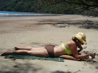
Quality time on Cheyne’s Beach

It was pot luck selecting Cheyne’s Beach Caravan Park. Disappointingly, we found it situated well back from the beach with no view of the sea which was a pity because it is a picturesque area with granite boulders balanced on peaks surrounded by a national park and a wide, flat sweeping beach that swoops eastwards for at least 20km. Christmas season means no choice. From our adjoining sites we have watched the park steadily fill up with families. Opposite us a particularly large site has five caravans and a marquee set up in a horseshoe with their vehicles closing the laager. Just behind us was a group of six young yuppies with their “boy’s toys” which includes their fancy vehicles, quad bikes, fishing tackle and surf skis. Kids playing cricket on the roadway; boats on trailers and tractors line the front end of the park and quads in general definitely rule. Our nights have been cold and the first parts of the day very “English” – grey and drizzly with cold winds blowing that campers are togged up in beanies, jumpers and jackets. Fortunately, between each passing “front” we get good bouts of sun around midday. Regardless, we happily enjoyed family time, leisurely brunches, exploration of beaches and a visit into the National Park on 4WD tracks. This, to the glee of Paul and Harley being bounced around Skiv but not the best thing to do with a seven month pregnant daughter!

Sunday, December 17, 2006

Week 38 (10th - 15th December)

The weather man got it right! By Saturday evening banks of clouds were moving in on Ceduna and that night temperatures plummeted from 45°C to 25°C, the air conditioning went off and we awoke Sunday morning to very overcast skies and a change in wind direction. It appeared to be a good day to travel until we were on the road dealing with strong crosswinds! Approaching Yulata we somehow missed the longest fence in the world - The Dog Fence which stretches 5 300km across three States – for the second time! We missed it on the Stuart Highway near Coober Pedy and again on the Eyre Highway. We must have blinked at the wrong moments! Since our first sighting of the dingo fence in April we have learnt that solar powered electric fencing is used in some places and boxes emitting high frequency sounds to deter dingoes in others. Heavy rains may sweep away kilometres of fence and patrolmen must get there to fix it as soon as the boggy ground allows. In 1989 some 20 000 sheep were lost to dingoes when the fence in South Australia was washed away. Predictably, without dingoes to keep foxes, cats and kangaroos in check on the other side of this 1.8m high protective fence, their numbers have proliferated. Second time along this route and our timing hasn’t coincided with the whale watching season. Hopefully, third time lucky next year!

We chose to overnight in one of the scenic lookouts on the edge of the Bundy Cliffs and suffered a very disturbed night with heavy gusts of wind battering Getaway. The noise and the motion wouldn’t let up, even the clothes hangers in the cupboards were rattling and by first light we wanted out of there! We made for the State border with a tail-wind in our favour, munching on our stock of apples in an effort to finish them before we reached the Quarantine Inspection Centre.


Nullarbor “Christmas trees” captured our attention as we whizzed by that we had to turn back each time to photograph them for this festive season.

Nullarbor Xmas shoe tree - CHEERS

The Madura Pass lookout above the Roe plains was an ideal place to pull off for lunch at 1:00pm. With lunch finished Lea collapsed on the bed feeling the effects of the night’s sleep deprivation. Both of us were inclined to camp there overnight until strong up-draughts of wind rising over the escarpment set Getaway into a rocking motion again. Further, to our consternation, George discovered that it was 10:30am Western Australia time! This threw us and our meals into disarray and by 2 o’clock we departed in search of a camp that would give us a decent night with good wind protection. We wound up at Moonera Tank, a camp we used last time round with trees to take the brunt out of the wind.

A hop of 350km the next day brought us through a bit of cooling rain to the Fraser Range where the rest area overlooked an empty large red clay pan, striking against the fringing white stemmed eucalypt woodlands. George walked out into the centre to take a photo and returned with clay encrusted feet ensuring we’d walk around the edge later that evening as the sun dipped away.

The next morning a clear blue sky contrasted against this red pan and we knew we were in for a hot day as we set off for Norseman. We were held up for an hour at the site of a road train accident with tow trucks equipped with cranes hauling up the over-turned trailers. The driver obviously didn’t heed the warning “Don’t Drive on an Empty Sleep Tank”, the horse squashed flat, together with three cars being transported and a huge load of steel pipes.
While re- fuelling in Norseman we again admired the unique corrugated camels on a roundabout in the town centre, a tribute to the early camel trains which carried freight and influenced the width of streets so that camel trains could turn. In keeping with the Festive Season we have popped in a photo of them.

Tin Camels in Norseman

En route for Esperance we stopped off to see Bromus Dam, a strange earthen, above-ground catch dam in the middle of nowhere. A small square shaped impoundment, almost empty, with no explanation as to its purpose. We ended up staying for lunch and by the time we got back on the road a strong headwind from the coast had developed and rather than battle against it, pulled into Kumarl Siding for the night taking shelter amongst a thicket of mallee and melaleuca.
Driving towards Esperance the next day the first of Western Australia’s wheat-fields arose and with them we began to see many dry lakes with white, salt encrusted floors, a reminder of the region’s salinity problem arising from the clearing the land of naturally occurring deep-rooted forms of vegetation. The Pink Lake is another exceptionally large salt lake on the outskirts of Esperance close to the caravan park we booked into. The pink colour of the lake is produced by a green alga and a bacterium that are able to survive in the extremely high salinity of the water and protect themselves from “sunburn” by producing a red coloured pigment (carotenoid). This same pigment produces the pink colour of flamingos in the salt lakes of the Rift Valley in Africa and in the Hutt Lagoon (north of Geraldton) the algae are farmed for the food colouring and dietary supplements derived.

Pink Lake - Esperance


Having spent a couple of camping holidays in the Esperance area in the past we were eager to re-do the 36km long Great Ocean Drive where the sheer beauty of the white beaches and bluest of clear blue seas with their breakers pound against massive granite headlands never fails to impress. Just offshore the many islands of the Recherche Archipelago add to the grandeur of it all, a drive not dissimilar to tripping around the Cape Peninsula.

Esperance beaches - Great Ocean Drive

Friday took us east of Esperance to the Cape Le Grand National Park with its rugged granite peaks, sweeping heath lands and blinding white beaches. Our plans to go and stay there changed when we heard a fire had swept through the park last weekend closing it. In Esperance we were told only parts were closed and having been there eight years ago we knew it was well worth a day visit. The weather was perfect for walking on the 22km length of le Grand Beach which easily rivals Cable Beach, Broome for all but its warmth. All the beaches in the SE corner of Western Australia are remarkable for their magnificence, the sense of wilderness one feels and the absence of commercial exploitation.

This is our last opportunity before Christmas for our blog manager Saxon to load this update. We have arranged to meet Paul, Saxon (with bump) and Harley dog next Friday at Cheyne Beach, approx. 400km west of Esperance, for 10 days together. The next blog will only be posted in the New Year and in closing we wish you compliments of the season.

Saturday, December 09, 2006

Week 37 (2nd - 9th December)

Our first overcast skies with fine drizzle provided ideal walking conditions on Saturday morning for King Canyon’s Rim. Early morning or evening hours tend to co-incide with tour groups and this morning we had to be particularly nimble to get up and away before the bulk began the strenuous ascent the trail begins with. Lea was gasping and quite weak at the knees by the time she reached the top. From afar the George Gill range appears very ordinary yet concealed within those mountain tops a warren of layered terraces and tiers of cone shaped rock formations carved over millennia by water and wind erosion. Natural platforms opened out at numerous points on the lip of the gorge providing wide vistas of the desert and the 270m drop below. Deep crevices and chasms, wooden bridges and precariously placed gangways all added excitement to a remarkable hiking experience. In the upper reaches of Kings Creek with its rare and relic plants the calls of delighted frogs and birds drifting upwards from the chasm containing the “Garden of Eden” was a sight to behold. The effort the Territory has put into selecting an exciting route and installing the infrastructure required (emergency radios included) is first class. “You will never, never know, if you never, never go”! Our opinion of Kings Canyon changed from the ordinary to become truly majestic. No wonder Qantas used the rim for their TV ad. of the Australian Youth Choir singing “Still calling Australia home”.

Cross-bedded and multi-layered sandstone outcrops on top of Kings Canyon

The 300km drive to Yulara took us through open sand-dune country characterised by stands of widely spaced desert oaks and the grey skies stayed with us all the way. Shortly after turning onto the Lasseter Highway George pointed out “Uluru” on the horizon somewhat stunned that we could see it when we still had 130km to travel! When we stopped for lunch just east of Curtin Springs we began to have some doubts and soon realised we were looking at Mt Conner, a forgotten monolith. Once within the Uluru-Kata Tjuta National Park “The Rock” loomed large and iconically familiar. We had no option than to book into the Ayers Rock resort, a town in itself. Although cloud cover precluded the likelihood of a sunset we set off for the World Heritage Site, paid our park entry fees (valid for 3 days) and drove around the perimeter of Uluru. Never did we imagine there were so many different faces to this gigantic red rock as the typical views suggest it is essentially smooth with rivulets running downwards. To the contrary it is heavily indented, pock-marked and stained. How we wished Lea’s Dad had been with us as we so often discussed whether the granite mass of Ngomo-kurira in Zimbabwe was equal in bulk to Uluru. We concluded Uluru may be larger unless its desert setting enhances its size!
Just as we finished our round at the point where people climb Uluru (closed due to rain) the sun broke through the clouds and the western face of the rock started to assume a deep shadowy red. The climb is not prohibited but it has great spiritual significance for the Anangu people who request visitors respect their law and culture by not climbing. With half an hour to sunset we joined the throng at the sunset lookout. Many highly organised for the dipping of the sun with their tables and chairs, chilled wine and snacks.

We returned to Yulara keen to send off last week’s blog before the internet kiosks closed. We were told there were no laptop facilities available unless we went to the Sails in the Desert Hotel where, to our horror, the only option was to purchase a 24hour package for $25! It is very hard to believe that in a compulsory tourist venue as large as this there is not the usual $2 for 15 minutes access. Back in camp we had two feral rabbits nonchalantly hopping around Getaway while just over the dunes Saturday night’s disco disturbed us well into the early hours.
Nevertheless we were up with the larks and off on the 50km road trip to Kata Tjuta (the Olgas) to do the 7.4km “Valley of the Winds” walk. Our timing has proved perfect considering the high temperatures we’ve been subjected to up until this weekend as the National Park closes its walking tracks during periods of extreme weather conditions. We had blue sky covered in thin sheets of cloud and a sharp nip in the air as we began our circuit through some of the 36 tall, steep-sided, awe inspiring domes of Kata Tjuta. They are often overlooked – the tallest dome is in fact 200m higher than Uluru. True to its name the wind speed was accelerated by the tunnel-like walls that twisted and turned, rose up and down, between the massive heads of rock. The path took us over a variety of rocky surfaces that tended to spoil our appreciation of the place because of the vigilance needed for every step. After two consecutive days of challenging climbs Lea’s knees sounded as if they were grinding sand within them and she was glad to reach Skiv where, on the homeward journey dozed off until George braked suddenly for a Thorny Devil in the middle of the road. After taking this unusual little ant eating reptile to safety it refused to remain still for a clear photograph. How delighted we were to see one in the wild.

Within the Valley of the Winds - Kata Tjuta

That evening we were well prepared with a ginger beer shandy and snacks for the going down of the sun. We arrived in good time to find ourselves a park on the sunset strip with clear visuals of Uluru. George busied himself taking photos of couples! One fellow battling to balance his camera on his stock of bottled water for a “self take” was very grateful; another lady was all embarrassed by his offer only to change her mind as he walked away. Looking through his binoculars George began giving a running commentary on people climbing down Uluru backwards. We became so interested in the goings on I that directon that we checked the position of the sun behind us and quickly drove to the point where climbers ascend/descend. It was fascinating to watch the cautious way folk descended, some on their bottoms, others treading sideways holding the climbing chain and taking frequent rests. Once down many had to do stretching exercises to unlock their aching knees. We noticed six plaques attached to the rock and found they all were to the memory of people that had fallen to their death on Uluru, mostly in the 1960’s. Just days ago we heard on the news that a man had to be choppered off the top after he had made the climb in plastic shoes (probably the fashionable crocs), which he took off half way and by the time he reached the summit his feet were so badly blistered he couldn’t walk. Considering the severe gradients involved it defies belief that someone would wear such inappropriate shoes. In deference to the wishes of the traditional owners we resisted the itch to attempt the climb and dashed back to partake in our sundowners overlooking “The Rock”.

Packed up and ready to go Monday morning we returned to Uluru one last time to do the 9.4km Base Walk. Being up close and personal to Uluru towering 348m above us we became particularly aware of the many caves, gullies and erosion features that one would otherwise miss as vegetation conceals them. Pools of water from the recent rains we’d had indicated the amount of water that must stream off the rock mass down its numerous gullies. To be there during a heavy downpour must be pretty spectacular. On the north face were most unusual patterns of erosion, which Lea thought resembled ancient Sanskrit messages written at a time when the level of the sandy plain was much higher. On occasions the path would lead well away from the many sacred sites that occur around the rock and, although perfectly understandable, spoilt that part of the walk. Rustic benches beautifully crafted from carefully selected branches of natural hardwood were placed at restful places and although they looked inviting Lea was not prepared to linger in fear of her stiff joints seizing.

Erosion features on north face of Uluru

We drove steadily for the rest of the day re-joining the Stuart Highway and finally stopping at the Northern Territory/South Australia Border in a particularly well-laid out and immaculately maintained rest area with display boards giving historical information and attractions in both States. A wonderful example of State co-operation for the benefit of the travel weary!

Mercy! You actually have to do this drive along the Stuart Highway to believe how over-grazed, flat and desolate the northern parts of South Australia are. We keep seeing Commonwealth Prohibited Land warning signs suggesting there is little use for these ‘wastelands’ other than for military purposes or, heaven forbid, nuclear waste disposal! 35km out of Coober Pedy, the opal capital of the world, steadily makes an entrance with conical heaps of white waste rock spreading across the horizon, becoming more and more extensive as the town draws near. In a town where the sun beats down relentlessly we saw no trees, no lawns, no greenness of any description, just rusted equipment lying higgledy-piggledy awaiting a day it might come in use amongst corrugated iron shacks. The main street full of places selling anything and everything to do with opals and all we wanted was an internet café. Spotting Radeka’s with easy parking for our rig George went in to send off our belated blog. He was back in next to no time beckoning Lea to leave the hot truck and join him in the coolness of an underground internet café. Walking into the motel a ramp led us below ground level into a reception and bar area before opening into a circular room with a rough textured domed ceiling carved out of white and orange rock rising from tiled floors. Arched recesses displaying opal jewellery had been carved into the walls on one side and computers installed on the other half. We were intrigued by it all and the receptionist readily told us that of the 3 000 people living in the town, more than half live underground. She provided us with a town map and suggested the best mole- ish places to visit.

Underground internet cafe at Radeka's - Coober Pedy showing colour of rock walls

We followed her recommendations and went to the underground Catholic Church (St Peter and Paul’s). Sadly for us Faye’s underground home, usually open to the public was closed and our attempt to find the home of eccentric old “Croc Harry” failed amongst the labyrinth of dirt roads out in the opal fields.

With temperatures back in the forties it was too hot to hang around and we got back on “The Track” and kept going until evening before pulling into a ‘major’ rest area as South Australia calls them if they have toilets. No trees, barely a breeze with stony orange ground going for ever. However, to compensate we had a spectacular moon rising, burnt orange in colour due to dust. To cool down before bed we took a bucket bath in the moonlight.

We had more of the same landscape next day this time round with a few dry, gleaming white salt lakes to break the monotony. Lake Gairdner is one the biggest inland salt pans in South Australia used on occasions in attempts to break world land speed records. Along this stretch of the Stuart Highway we saw far more of the Trans Australia Rail line which made us wonder whether overseas tourists travelling on The Ghan into the interior are dismayed at the starkness of what they see. On the other hand history comes alive when thinking of the likes of Sturt, Stuart, Burke and Wills and others traipsing around in unbelievable heat in this flat, featureless land searching for water and a route across the “promised land”.

At the Pimba junction we crossed the point we’d passed in April this year, en route to Andamooka, so closing a 28 000km circuit. That’s something of a milestone for the Rubber Tramps. We hoped to replace the gas regulator in Port Augusta. It should have been done in Broome when it first began giving trouble only it meant hanging around for a gas fitter. The gas stove is non-functional and of three gas fitters in Port Augusta no-one could find time to help. That seems to be the story in the Outback – tradesmen are overworked!

A bush stop was preferable to a caravan park and we rolled on westwards out of Port Augusta taking the Eyre Highway across the top of the Eyre Peninsula. Once again the western sun began to blind us and we pulled into a roadside rest area. We were disappointed to find it too close to the road until we noticed a track leading off into a network of bush camps. We took the furthest one. When one comes upon an unexpected gem we get a real kick out of it. When George came to mark the spot on our map he found we were actually camped on the edge of the Lake Gilles Conservation Reserve, a large tract of undisturbed mallee woodland. That evening temperatures dropped to the extent that we had to haul out our “Skehel rugs” again. The proximity of the Southern Ocean was evident. We slept well in the cool air, arose late and changed routine by spending the morning at rest and only going back on the road after lunch.
We were out of flat land. The long black road rose and fell like a serpent or dragon’s back in front of us running through huge fields of yellowed wheat stubble. Heat was getting at us and the sun seemed too high for the hour by the time we stopped at the Old Perlubie School Site for the night. George checked South Australian time on his computer and found time zones had caught us again along with day-light saving.

Little temperature drop during the night and we knew we were in for a bad day when the thermometer in Skiv shot up 10 degrees in the first hour of morning. By the time we reached Ceduna a hot, strong blustery wind whipping up dust had set in and the temperature was back in the 40’s and climbing. We booked in at Shelley Beach for the weekend and laid low in the tormenting weather. A new gas regulator was fitted.
A walk on the beach late Friday night was hard going and this weird weather continued into Saturday. Just as well we are not attempting the Nullarbor under these dreadful conditions and hope the approaching cold front will cool things down before we leave Ceduna tomorrow- Sunday.

Friday, December 08, 2006

Week 36 (27th November - 1st December)

“A town like Alice” …. is like no other! We simply weren’t prepared for its incredible setting and we have been blown away by its unique and rugged desert feel that somehow epitomises an outback town in quite the best way. The restricted vision of a single photo has really come home to us in this town because the broader panorama creates the very essence and sense of place that we have experienced. The dry, sandy bed of the Todd River, lined by magnificent red river gums, weaves its way through the town. The large rocky outcrops (kopjes) skilfully integrated amongst the urban fabric, including Anzac Hill overlooking the CBD, with its wide vistas of the ancient, heavily fractured MacDonnell ranges displaying the distinctive “Gaps” that serve as the entry and exit routes to the town.

Looking down on Alice Springs from Anzac Hill with Heavitree Gap in background
This was certainly not the time of the year to visit Alice. We have found it hard to walk around in the grip of hot, dry winds desiccating our skins and sun beating down relentlessly. It has made us very aware of the calibre of the early explorers and settlers that did without all the creature comforts we are reliant upon to make life bearable. Not to mention those who died from this merciless heat and dehydration. Our air conditioner has been running non-stop. The fridge has worked overtime to keep us supplied with cooled water. It is not inefficient it is unable to keep up with the demand. Within Skiv the amount of warm, solar heated water we’ve consumed, in desperation to quench a thirst must be a record! For our sanity we have decided that from here on to take powered sites in temperatures of 40 plus to run Getaway’s air conditioning unit.
We walked Todd Mall to see its points of historic interest and to get a feel of Alice’s heart and inhabitants. We walked Desert Park – a particularly wonderful window on desert ecology incorporated within the town limits which is another remarkable attribute. A dramatic feature was the enormous screen in the cinema that dropped away once the film was over to reveal the majestic MacDonnell Range. And we walked the Telegraph Repeater Station alongside the Todd River with its “spring” (really a water hole named after the wife of Todd, the telegraphic superintendent of the Overland Line) that eventually led to the town of Stuart being renamed Alice Springs to avoid confusion. While in Darwin the headline “Lost Brit Lampooned” in the Northern Territory News had caught our attention and on reading about the “bumbling Brit” who wandered off a well trodden path at the Telegraph Station, became disorientated and spent four days lost in the bush! He was rescued after calling the police on his mobile phone and came back looking like a freshly cooked lobster. Before leaving Alice Springs the bumbling Brit proceeded to get lost a second time! We didn’t understand the situation never having been there on reading the article at the time. Now of course it sprang to mind being at the Station and no ways could we credit being lost for a day, let alone four.

We finally had the pleasure of meeting Anne & Will Cormack after all the years of being told that if we ever got to “Alice” we should look them up. First, by Coralie when we immigrated, later by cousin Anthea after she raved about her stay in their Nthaba B & B Cottage and then more often by his sister Liz! Our phone call immediately elicited an invitation to dinner in their beautiful home where we spent a wonderful evening in their company joined by their son and grandsons. We didn’t see the roses Anne is renowned for as kangaroos had devoured them never the less her garden’s a fine example of what can be achieved in such aridity – the Oleander frontage the showpiece in our minds!

Out we rolled Wednesday morning down the broad valley between the serrated mountain ranges of the West MacDonnell National Park to Glen Helen. En route we stopped briefly at the memorial to John Flynn, the founder of the Royal Flying Doctor Service. His ashes are interred in the memorial topped by one of the Devil’s Marbles brought in to honour his achievements.
The sealed road ended at the Glen Helen Homestead where we camped for the night looking up at the towering red cliff face of the Pacoota Range. The Finke river said to be the oldest river in the world and 700km long, runs through the Glen Helen Gorge. A large waterhole lies at the entrance preventing access into the gorge. This is one of nine permanent waterholes to be found along the length of the entire river. In the afternoon we drove to the Ormiston Gorge – a breathtakingly beautiful gorge with red walls that simply soared upwards on the one side. After George had a swim in a waterhole that was too rich in algae for Lea’s liking, we sat on the shady side of the gorge absorbing the silence broken at odd times by a crow’s harsh chattering.

Ormiston Gorge

We drove a section of the gravel road, a short cut to Kings Canyon, to gain a feel for its condition before we purchased the permit required to travel through Aboriginal land the next day. Stepping out to go to the ablution block that night a lovely sight met our eyes. The Homestead below us had floodlit the red cliffs. As we stood in the balmy air admiring them the first drops of rain began thudding into the dust around us. We turned off the air conditioner in error thinking we’d have a cool night of rain but within the hour it was stifling again.
As the orange glow of dawn broke behind us (part of our new “cool” travel strategy) we carefully made our way down the Namatjira portion of the road that led to Tnorala Conservation Reserve (Gosse’s Bluff) where we’d planned to have our breakfast. This extraordinary ring of rugged hills that rises abruptly from the surrounding plains is an ancient meteorite crater. George stopped a couple of times to photograph the early morning sun hi-lighting the rim. The track leading towards the crater looked dreadful and required 4WD that we decided against a visit and on the next rise further down our road we stopped to breakfast overlooking the Bluff. Entering Getaway we found the fridge door catch had snapped and our tray had shaken off the seat. Not bad for 60km of off-road travel! MacGiver George fixed the fridge making a catch with an ice-cream lid and taped the door for extra strength. Over breakfast we decided the road was no worse than The Savannah Way so we would take the Mereenie loop road that we had the permit for.
Back on the move we came to the sign-posted entrance to the Tnorala Conservation Reserve. 4WD was recommended yet the road looked fine. We took a chance and turned in only to find it narrowed and looked pretty sandy. With the crater so near we couldn’t give up. Executed a U-turn, unhitched Getaway and off we went in Skiv. Most surprised to find that we were able to drive through a gap into the centre of the crater. To stand and gaze around at this remarkable astro-geological feature, 5 km in diameter created 140 million years ago with the impact of a comet apparently one million times more powerful than the Hiroshima bomb brought home the climatic repercussions of these large scale explosion events that periodically led to the mass extinction of life. We didn’t linger too long and returned to Getaway.

Gosse's Bluff - Tnorala Conservation Reserve

The Mereenie Loop Road is 154km of gravel and for the first hour we were lulled into a sense of complacency. The road was in good condition, the scenery was interesting, more rain seemed to have fallen in this area suppressing the dust with the odd puddle attracting some brumbies with foals. Along the road we could see a mass of footprints which George recognised as camels, confirmed in the next creek bed where we saw three which pleased us no end. This turned to further excitement much further on when we rounded a corner to see a herd of about 60 camels disturbed by the noise of our rig loping away. Grabbing his camera George abandoned Skiv and rushed over the rise they had disappeared behind. Before long he was back beckoning Lea to join him to listen to the incredible guttural bellowing emanating from these ungainly creatures as they headed up a drainage line. We intercepted them further up the drag allowing us good views of the young ones concealed amongst the herd. The heyday of these introduced freight animals came to an end in the 1890’s with motorised transport. Many were released to run feral in the Central and Western deserts expanding to become the biggest population of wild camels in the world. We spotted several other herds on our journey and the road was littered with their spoor.
Herd of wild camels - 70km N of Kings Canyon

There is only one authorised road side stop within the permit area of this road and ridiculously it turned out to be 27km from our destination. As we grew steadily restless and tired, the road became more corrugated and required even slower navigation. Approaching a corner two 44 gallon drums each with the words “Lift um foot” attracted our attention …. completing the S-bend was another drum scrawled with the same white paint saying “Put um down”. In our hot and hungry state we were further weakened by a fit of giggles! A rock painted “Ginty’s Lookout – 14kms” dashed our humour and the road degenerated further. Crawling into “Jump-Up Lookout” / rest area, as officially named in our permit, we stiffly climbed out of Skiv and opened Getaway’s door to mayhem. The fridge had sheered the screws put in at Broome and once again broken out of the wooden cabinet. As a result the fridge door had broken through the taping and opened spreading the two vegetable drawers out over the floor. The kitchen drawer catch had unscrewed allowing the drawer to fall out shedding our utensils everywhere. Bottles of water, butter and cheese had flown off shelves and burst open. A cupboard door was hanging lopsidedly from one hinge. Cleaning up and seeing to minor repairs in a confined space with heat melting us as well as our groceries hardly made for a good lunch break … and flies came pouring in for the party!
Anxiety building over the fridge and no means of securing it Lea preferred to keep it propped into place with her back for the next 27kms and arrived in Kings Canyon resort looking somewhat shell-shocked, adamant we’ll never travel extensive dirt roads again! Hot and bothered “yesterday man” George immediately began trying to solve the problem of the fridge. Having seen how the fridge had been secured in Broome George now had a good understanding of what was involved. Refusing a refreshing shower and no cool water to quench our thirsts he went off in search of the resort workshop where he was able to scrounge a piece of aluminium and buy some life saving ice to conquer our thirst on his way back. Thereafter, with his own tools he was able to re-secure our fridge - probably in a more stable manner than ever before. We were too exhausted to think of exploring our surrounds that evening let alone think of activities for our next day. Nor could we get up in the night to collect our towels outside when the rain beat down on the caravan and thunder rolled over and above the sound of the air conditioner.

Soon after dawn we were up to find the night’s weather had been more noise than wet and before breakfast set off into the Watarrka National Park for our first visit to Kings Canyon. With a fair amount of cloud cover around we were sorry we hadn’t thought to bring breakfast with us as the conditions were ideal for doing the Rim Walk. Instead we walked up Kings Creek along the floor of the canyon to a platform giving views of the sheer canyon walls before returning to camp for breakfast. We were content to spend the heat of the day reading, writing and being still! Our intentions to return to the canyon for sunset were blown by an unexpected summer thunderstorm accompanied by a lot of lightning, some a little too close for comfort. It cooled things down nicely and while the storm continued to rumble and grumble around us for most of the night the sweet smelling breezes it spawned meant we could do without the air conditioner for a change.
We move on tomorrow at first light to do the rim walk and then make tracks for Uluru, so we are cutting this week shorter than usual.

Thursday, November 30, 2006

Week 35 (20th - 26th November)

We took the Overlander’s Way, originally built as a Cobb & Co. coach route and served as an important supply line during World War II. After putting Townsville well behind us the countryside grew steadily flatter and drier and, as crows put in their appearance once more pecking at bloated kangaroos lying dead by the roadside, we could not help reflecting on the joys of the luxuriant rain forests we had left behind. Although Roger’s comment “rain forests are dripping wet with no view” made us smile and ponder another opinion as we were overtaken by road train after road train.
Our first night was spent alongside the dry bed of the Campaspe River, sandwiched between the railway bridge and the road bridge in a well shaded spot with plenty of bird life flitting between the riverine trees. A distant clinking struck a chord in Lea’s memory of a windmill and as evening came George took a walk up the river bed and found the old metal windmill dribbling water into a rusty tank, a good few leaks to supply water to some grateful birds and kangaroos.

509km covered on Tuesday! Not because we wanted to but simply because the miles and miles of scrub and grassland utilised as cattle stations that stretched out in all directions around us, afforded no decent rest area. Even in the little communities along the route we couldn’t bring ourselves to pay for a caravan park where the sun beat down mercilessly and looked little better than the rest areas. And so our mileage crept up … The long day’s travel was broken by the interest that began developing on our arrival in Hughenden, to find “Mutt” the life-sized replica of a Muttaburrasaurus standing on a street corner. We discovered that we were travelling across a vast prehistoric inland sea rich in marine fossils. Sculptures by local artists depicting an ammonite, a pterosaur and “Darby” the dinosaur caught our eyes with the ingenious use of scrap metal. We were also most taken by a windmill rotunda we found in the middle of a wide street. Queensland seems to like the use of the word “rotunda” as we’ve seen it often and take it to mean a round meeting place.


Mutt the Muttaburrasaurus in Hughenden

U Think They Saurus … was followed by a moments hesitation before it tickled our imaginations. This was the first of several signs about Kronosaurus Korner as we approached Richmond which proclaims to be the fossil capital of Australia. We decided we had to visit a place with such a quirky sense of humour. First we needed our lunch and the Lions Park fitted the bill with its green lawn and a place to park in the town centre. We noticed the edging of the lawn and a commemorative cairn had been made of strange round rocks. During our visit to Kronosaurus Korner we discovered these nodules are a unique feature to the Richmond Shire and are appropriately known as moon rocks. Richmond hosts a bi-annual moon rock throwing competition – shows how many of these moon shaped rocks are around. Cartoon-ish sounding Kronosaurus Korner turned out to be an exceptionally interesting and well presented marine fossil museum containing the remains of the Richmond pliosaur (the best preserved skeleton in the world), ichthyosaurs, the dinosaur (Minmi – preserved so well that even part of its stomach contents were intact) and Kronosaurus – the largest marine reptile to ever live, so huge, with teeth the size of bananas, that he could have eaten T. rex for breakfast.


Kronosaurus Korner - marine fossil museum at Richmond
Back we went to the uneven, patched up, and “make do” road which needed all one’s concentration, all not helped by driving due west into the setting sun with temperatures of 40°C. Unable to shield our eyes any longer we abruptly pulled off into a clearing that suddenly materialised, determined to go no further! What a haven it turned out to be, apart from the flies which we didn’t have to suffer long, as night was almost upon us.

The worst section of the Overlander’s Way, best described as forgettable landscape, appeared to be over by the next day once we reached Cloncurry. Thereafter we meandered our way through the Selwyn Ranges with its dramatic rocky outcrops. One in particular looked like it was out of a cowboy movie with black kites circling above it in vulture fashion. Spinifex was back covering the foot slopes and, on a road that was decidedly better than yesterday, we made good time to Mt. Isa.
This statement appears in The Isa Visitor’s Guide welcome … “Mt Isa is one of the largest cities in the world, covering an area the size of Switzerland and with a main street 180km long!” We had to check this out as George could not credit it.
We took a ride around town as we wanted to see the underground hospital and the National Trust tent house, a style of house unique to Mt Isa in the early 1930’s, only to find all tourist attractions close at the end of September. Only mad dogs and ….. go out in this noonday sun! The “huge” city was done in next to no time and stopping at the Outback at Isa complex we established that the reason Mt Isa was once listed in the Guinness Book of Records as being the largest city with the longest main street is earned on a technicality. The Shire boundaries form the “city” and Camooweal, a “suburb” 180km away, falls under the jurisdiction of Mt Isa. Clearly, it’s nothing but a publicity ploy. An extra day was spent in Mt Isa in order for Skiv to have an oil change while Lea got our laundry done.

We were sweltering before we even pulled out of our caravan park for Camooweal on Friday. Casting an eye at our temperature gauge, reading 38°C so early in the day, we wondered where it would be by midday. Camooweal was nothing to shout about and with the thermometer steadily rising we wanted to put as much mileage as possible behind us. 13km further we crossed back into the Northern Territory to be surrounded by seas of sun-bleached yellow grass stretching to the horizon, a shimmering black road, edged in red soil that had been scraped clear of vegetation, lay endlessly before us. This was the Berkeley Tablelands, with warnings about cross winds and headwinds and no fuel for hundreds of kilometres. In the distance trees mirages danced and, under one scraggly shrub, cattle huddled together believing they were in shade. No windmills, no waterholes, dry creeks and river-beds, left us gulping down water and wondering how they survive. Through the heat haze we began to see grey columns rising and dissipating. These “cock-eyed bobs” (whirlwinds) became clearer as we passed through burnt out land and in one spot we had a heart-stopping moment when one engulfed us, sending us lurching sideways. We’d had enough of the western sun streaming directly into the cab and hot air blasting through the windows that when Berkeley Homestead offered shady, lawned sites we couldn’t resist this oasis. We flew out of Skiv into their swimming pool and wallowed for a good hour watching a truckie fastidiously polish all the chrome on his gigantic “mean machine”. Later a mud lark hopped into the caravan and checked out the floor as we sat mesmerised by our little guest. The sound of the Homestead’s generator beating away rhythmically and the warm air clinging to us, we felt as if we could have been in Beit Bridge as we tried to sleep.

More of the same next day as we as we completed the Overlander’s Way passing through huge tracts of sunburnt land. The heat drained us of conversation. At one time Lea leant back and said she had to think of England in a desperate effort to ‘feel’ cool when, lo and behold, against the expanse of blue sky appeared a streak of vapour trail, very much like the criss-crossed jet streams of NE Lincolnshire skies. Turning south on joining the Stuart Highway our hearts sank at the sight of another substantial distance to be covered across Central Australia in these high temperatures. We re-fueled in Tennant Creek and made haste for Devil’s Marbles Conservation Reserve where we thought we’d spend the night. Running parallel to the Stuart Highway the telephone line prompted George to babble on about the epic construction of the original overland telegraph line. Completed in 1872 it ended Australia’s communication isolation from the rest of the world when a single strand of wire was strung across the country from Darwin to Port Augusta. The 3200 km long line, built through the most inhospitable terrain with the aid of camels bringing in the poles – no less than 20 for every mile - connected Australia to a submarine cable from England. Lea retorted “so much for communication in 2007 when our mobiles are operational over only 12% of the country”. Just as well we arrived at the Devil’s Marbles and were distracted by the huge rounded boulders. Aboriginal dreamtime legend describes them as eggs of the Rainbow Serpent. Geo-morphologists use the term “cheeserings” because they resemble flattish lumps of cheese. The name Devil’s Marbles appears to date back to a description of the place when laying the telegraph line back in 1871. Lea thought The Cheese Factory would be just as suitable.

Rounded granite boulders - Devil's Marbles

With barely any shade in the campsite and the reflected heat off the granite, by the time we had finished our lunch we knew we’d been there long enough!
Next place on the map was Wycliffe Well, supposedly the UFO capital of Australia. Hitch-hiker Ed had told us about this place so our interest was piqued. We were startled to find a “Big Four” here, more so that this upmarket caravan park could have derelict cars, litter and beer cans strewn everywhere on its border. We could only believe a UFO had created this havoc! We passed on this overnight accommodation too.

Approaching Barrow Creek – our imaginations and curiosity came into play as this was the site of Peter Falconio’s murder and Joanne Lees’s escape that generated an intense man hunt in July 2001 with enormous media attention worldwide. During long hours on the road we have chewed over this case time and again with Paul, Saxon and Paula, as each of us completed reading Richard Shear’s book “Bloodstain – the vanishing of Peter Falconio”. Just as well it was a dark night as the bush where Joanne hid is very scanty and what she must have thought when her truckie rescuers took her to the Barrow Creek Hotel heaven knows as we were shocked by this seedy place. In comparison to the well kept historic Telegraph Repeater Station there, the hotel looked ram-shackled and down-at- the-heels, its “caravan park” awful.

Barrow Creek Hotel (Joanne Lees brought here by truckies)

Eventually clocking up 560km to our day, we came to roost up for the night in Prowse Gap rest area. Got the generator going and caught up on our blog with mighty “King of the Roads” thundering past, all lit up like Christmas trees.
Soon after hitting the road on Sunday morning we came to the turn off to Aileron with its queer sign BIG MAN WALKING. We turned in to see what it was about and immediately spotted the statue of the big man standing proud on top of the hill. There was nothing around to explain its origins or that of the enclosures outside the pub with a dingo, an emu and a young camel within. Following the short loop road back to the Stuart Highway the surrounds of a “sociable” tree caught our eye with its broken bottles and beer cans blighting the landscape. In fact, much of the wide roadsides of the Stuart Highway, from Tennant Creek to Alice, glittered with wine sacks, aluminium cans, glass and plastic bottles along with beer cartons, plastic bags, car tyres and a higher than normal amount of discarded (stolen?) vehicles. Ironically, the entrances to communities were thick with beer cans despite large signs warning of liquor prohibition beyond that point. Not only does it show appalling disregard for hiding the evidence but it is also a dreadful indictment of the degradation of self and country.

After the long, flat route with little relief in the form of high ground the sense of arrival in Alice Springs was heightened by its rocky, broken terrain that took us into the city. We booked into a very central caravan park, turned on the air conditioning and recovered from our journey, pleased to have arrived in the centre of Australia!

Sunday, November 19, 2006

Week 34 (11th - 19th November)

Rain began falling in the early hours of Saturday morning, the first good thumping we’ve heard on Getaway since crossing the Nullarbor. By breakfast we were having intermittent showers and the mountains around us were shrouded in cloud. We hoped that in departing we’d leave the wet behind us and thankfully that happened. We made Brampton Beach, 80km south of Cairns, in good time to select a beach side site for ourselves. An anti-stinger enclosure enabled us to have our first swim in the Coral Sea. Not the colour we would have chosen to swim in, with waves churning up sand or so we thought, until we entered the warm water. As we went deeper we became aware of currents of chilly bottom waters and realised it wasn’t sand being churned up by the waves to give the sea its turbid colour, but suspended clay. This lead us to think about the many man-induced problems that the corals of the Great Barrier Reef currently face – from sediment deposition to nutrient enrichment, not to mention coral bleaching due to global warming. Just days ago we heard on TV that some-one had proposed the government should give serious consideration to either covering the reef with shade cloth or pumping in cold water from deep offshore to alleviate the warming!

The caravan parks at both Wonga and Brampton beaches are municipally run and occupy prime beachfront positions within the coastal reserve making them very desirable in our eyes. Generally, all developments are kept well behind the foreshore with the road in front of them. That evening as we walked to the point of Brampton Beach we observed how many residents leave their outdoor furniture on the high water mark to avoid carrying it all back over the reserve that prevents them from truly having beach frontage properties.

With lots to see on the Great Green Way and November disappearing fast we didn’t tarry longer than 24 hours at Brampton Beach. In departing we noticed some of the damage caused by Cyclone Larry on the sea-facing slopes of the mountains. The many denuded / coppicing trees reminding us that we were approaching the area that had been in the eye of it all. We saw our first trains transporting sugar cane which jolted us because we hadn’t seen any cane suitable for harvesting as yet. The cane size in the many fields we had passed through looked immature in comparison to Natal cane at harvest time. All the trucks appeared to be carrying cane chopped to a size that made it look almost trashy. We need our cane farmer friend Raymond to advise us on our perceptions. As we neared Innisfail the banana plantations that Cyclone Larry had decimated earlier this year came into view. The differing stages of maturity on the plantations, lack of bags protecting bunches and empty road stalls made us wonder how long Cyclone Larry will hold Australia to ransom over a banana.

“Nothing compares - wander through the captivating charm of a lost castle of romantic dreams, inspired by spectacular waterfalls and nestled in the lush tranquillity of a mysterious rain forest. Delightful gardens whisper untold stories of the past”. So read the advert for Paronella Park that captured our interest. In 1993 Mark and Judy Evans, a Western Australian couple, bought a derelict, overgrown property on Mena Creek that over the years had been hammered by floods, cyclones and fire. The property had a history dating back to 1929 when it was built out of virgin rain forest by a Spanish dreamer, Jose Paronella. A baker by trade, he came to Australia in 1913 to seek his fortune and, by working and saving hard for 11 years, amassed a fortune buying, improving and selling cane farms. Romantic Jose returned to Spain to collect his fiancée only, he’d neglected to make contact over all the years and she’d married another. Undeterred he married a younger sister and returned to Australia to begin building the castle of his childhood dreams.

Refreshment rooms - Paronella Park

Such was his vision, ingenuity and capacity for hard work he achieved all that and more. His artistic abilities came to the fore when creating not only a home for his family but also an entertainment centre way ahead of its time. Besides using the waterfall on Mena Creek as a focal point to his property he put in a hydro electric generating plant providing power for his development 15 years before anyone else in the region had electricity. His castle with cinema, ballroom, tennis courts and magnificent landscaped gardens opened to the public in 1935. This visionary with his appreciation for beauty and fine hospitality died in 1948. A succession of catastrophe’s followed that all but obliterated Patronella Park. Years later the Evans couple discovered the shattered pieces of Jose Patronella’s dream as they cut back the jungle of their newly acquired property. Amazingly Jose’s daughter, now in her eighties, came to light and with her help they have set out to reinvent Jose’s legacy to tourism.

Arriving at Paronella Park we had in mind a stately home a la England not a strange little village scene. All was to be revealed in a series of leisurely tours throughout the day by enthusiastic guides taking us over the heritage listed remnants of the castle and gardens which are largely concealed from view yet cover 13 acres. We stayed in their little caravan park on top of the hill which enabled us to take advantage of all the tours at times to suit ourselves for a one-off entry price. The local Aboriginals sharing their traditional knowledge of bush tucker and indigenous dances proved shining examples of how well their own initiatives can be incorporated into a tourist based business.

The finale to our day at Paronella Park was the “Darkness Falls Tour” taken at evening time. Without the sun beating down mercilessly through the enormous gaps in the forest canopy left by the latest cyclone we were able to wander through gardens changed by the soft and fast falling light, the presence of fire-flies, bats and birds in flight adding their mystique. From the many avenues we had glimpses of the Mena Creek Falls which Cyclone Larry had inadvertently exposed bringing back Jose’s original intention. As we stood in the dark on the old tennis courts looking through an archway in a timeless old building that framed the falls, in true Jose Paronella style, its form was suddenly illuminated to divulge a lone saxophonist on the upper tower playing a haunting tune … thus “continuing his dream”.

Trailing back down to the coast and along Mission Beach, we made our next stop at Wongaling Beach overlooking Dunk Island. A no swimming beach which was a pity as the water was a lovely colour. We made do with walking and noticed that the beach profile was in the process of being mechanically reshaped to protect the mass of exposed roots along the edge of the beach reserve. Not a good beachfront management practice as their efforts to cure one problem will almost certainly lead to another.

Tully interested us because on our arrival in Ravenshoe four weeks ago in cold, drizzly weather we’d looked at a “rain pole” topped by Tully, the wettest place in Australia! The next town on our map was Tully so we called in there for fresh bread and milk. In the park we found the 7.9m high gumboot commemorating Tully’s place in Australian records as the town with the heaviest annual rainfall ever recorded.


7.9m high (annual rainfall) big gumboot at Tully

We have been zigzagging between coastal and mountainous habitats of late – After Wongaling beach it was up to the Murray River National Park. Parking Getaway within earshot of the 30m high Murray Falls we set up camp and spent the day reviving from the heat by taking regular dips in the crystal clear rock pools AND clopping march flies! Related to horseflies these sluggish blood suckers fortunately seemed to prefer men here. The “March Dance” as we came to call it is somewhat like the South African gum boot dance. In this case very amusing as the stamping and slapping occurs so unexpectedly. By nightfall we were the only ones left in the National Park. In the silence we hoped we’d see some night creatures but, other than fire flies flitting between the lofty trees around us we received no company.

Back to the coast! We made for Cardwell and Hinchinbrook Island – the caravan parks were well back from the beach and not appealing to us. We hoped Lucinda would be better so continued on there in time for lunch. Driving through the massive swamps of the Herbert Estuary a strong on shore wind began developing- cooled us down but wasn’t pleasant for beach walking. It wasn’t a wasted journey though as the world’s longest sugar loading jetty is here and George was keen to see that.
Found ourselves a shady spot to eat our lunch overlooking the sugar facility and the southern end of Hitchinbrook Island with Mt Bowen towering in the background. This mountain changed the life of Warren Macdonald in 1997, while climbing Mt Bowen, the highest of the many peaks on this rugged island. A freakish accident occurred when a massive slab of rock sheared off the mountain trapping him for two days and nights in a creek bed. He wrote an inspiring story “A Test of Will” about the dramatic rescue that followed and his determination to overcome the handicap of having both legs amputated. We, as readers were overwhelmed by his courage.

5.7km sugar loading facility at Lucinda and stinger net at Lucinda, with deep water berth & Mt Bowen on Hinchinbrook Island in background

The strength of the wind drove us inland to Ingham for the night. After carefully selecting our site and unhitching well away from the main road we were horrified when a train rumbled past within a stone’s throw of our doorstep! We are still bemused that we didn’t see that line especially as George had just remarked what a beautiful farm-like setting we had with cows lowing in the meadows and chickens scratching around!

The road to Girringun National Park was considered unsuitable for buses and caravans. As we were keen to see the Wallaman Falls (the highest single drop falls in Australia) we left Getaway in camp and drove across the cane covered flats and up the steep, winding road climbing to 540m above sea level where we found the spectacular falls. Plunging 268m into the valley of the Herbert River it made a very glamorous bridal veil with a rainbow catching the light within the spray. March flies irritated the hell out of George as he tried to capture the falls on camera.

268m high Wallaman Falls, Girringun NP. The highest single drop falls in Australia

Half way down the access road was a lovely view spot overlooking the Herbert River Gorge. No sooner had we stopped for lunch there than we heard a strange alarm and up the hill and into our lookout came an overheated VW Wicked , out of which sprang two Irish guys, very agitated about their hire vehicle and worrying about how much further the falls were. We had a good chat while their engine cooled. By now the coastal lowlands were scarcely visible, obscured by a heat or smoke haze. Returning to Ingham the ferocity of the heat hit us. On the news that evening we learnt that the temperatures had reached 36°C. After cold showers we sat in the shade of Getaway and noticed a tiny sunbird building its nest from spider webs in a spindly shrub a metre from us. So much effort in a position that is far from safe!

With a selection of 48 hour beachside rest areas available between Ingham & Townsville we took a look at each one until we arrived at the last- Saunders Beach where we had to stay. Fortunately it turned out to be the best. Having left the rainforests behind us we are finding the landscape very hot and dry looking. With strong on shore winds persisting we were kept well entertained by kite boarding enthusiasts who’d been drawn by the wind, forsaking their jobs for the afternoon. Just like Daniel, they were racing up and down through the waves, leaping into the air with twists and somersaults periodically crashing out in the shallows. After a shark had been spotted amongst them, George was asked to keep a lookout for the black fin.

On Saturday morning we drove into Townsville taking up a caravan site on the outskirts of the city. Spent the rest of the morning on The Strand where we happened upon the Tobruk swimming pool. Arising from our enquiries at the desk our sleuthing paid dividends. Amazingly, within the hour we had Roger Lebish on the line. An old friend from our Kariba days, we arranged to meet that night when he had finished his voluntary Coast Guard work. We had such a disturbed night with big trucks and trains rumbling past all night that in the morning we packed up and moved to Rowes Bay caravan park ideally situated to joining Roger and Judy in the late afternoon for a walk and dinner at their place. The Sunday markets lured us into the city for the rest of the morning where we brought some fresh tropical fruits to savour as we begin the hot, dry crossing back over the continent en route for Western Australia.

From here on it’s goodbye to the cool sea breezes and humidity which we prefer.

Sunday, November 12, 2006

Week 33 (5th - 10th November)

Whoa! Curiosity will kill the cats - Wonga Beach has helped break the habit of needing to see around the next corner. This place must be one of the best kept secrets in Australia and definitely a place to return to one day.
We drove through to Port Douglas for their Sunday market. Expecting something of a concrete jungle we found a very tasteful town steeped in lush tropical gardens and trees, set at the end of a small peninsula to give it an island feel. Adding to the vistas across the sea were the ever present mountains of the Great Divide. When our feet were sore from all the walking we found respite on 4 Mile Beach and had our picnic. Interesting to find a stinger barrier net in place for the cautious!
That night we watched the film “Seabiscuit” on TV. Afterwards, we found the full moon out in all her glory. All thoughts of bed fell by the wayside as we stepped onto our beach and took a long walk in its silvery light. On our return, a documentary on Grace Kelly caught our attention and we were immediately engrossed as it covered all the places we went to while in Monaco last year. Awaking next morning we knew we couldn’t leave here and stayed just one more night.

On Melbourne Cup Day when the whole of Australia comes to a standstill for a horse race we rolled out of Wonga Beach for Cairns. The Captain Cook Highway turned out to be most scenic route particularly over a 28km stretch that hugged the coastline south of Port Douglas as it cut through a section of the Wet Tropics World Heritage Area. Nearing the outskirts of Cairns we turned towards the Barron Gorge National Park and booked into Lake Placid Caravan Park. After an early lunch we shot into the city to find Sea Swift, the shipping company that offers trips to Cape York aboard a working cargo vessel, the MV Trinity Bay. We asked directions at the Visitor’s Information centre and gained the impression it was “just down the road”. We walked! We walked and walked in the hottest time of the day, with the sun eating into our skin, no shady side to the road, through industrial dockside areas with nothing even to look at en route, arrived as red as beetroots only to find they were fully booked to the end of the month. At least going we had anticipation, returning we had nothing but sore feet. Disappointed that we weren’t going to make the top of Cape York and the Torres Strait Islands we decided we’d travel the legendary rail route to Kuranda and come back on the Skyrail and made our booking for the next day. On our homeward journey the breathalyser teams were out in force checking Melbourne Cup revellers.

“FORTITUDE, SWEAT AND BARE HANDS … our journey didn’t come easy!” This rail line is an incredible feat considering the terrain traversed. Constructed by hand with basic tools and dynamite over the period 1886 - 1891 through dense jungle, over deep ravines, narrowly skirting cliffs with drops of hundreds of metres and across 45° slopes, these pioneers formed 15 tunnels, dozens of bridges and kilometres of track. From the moment we stepped into the charming past of Freshwater Station to await the arrival of the train we knew we were in for something good. The brightly coloured diesel engine seemed almost alien on arrival, but climbing into the carriage returned us to those early days of Puffing Billies. Once we set off the clickety-clack and swaying motion transported us back to the years of train travel we did in our youth. No time to reminisce as the cane-fields of the coastal lowlands rapidly dropped away and we began a slow spectacular climb up to the Tablelands we’d left two weeks ago. We have seen many faces to the Barron River from its source to the sea, including its impoundment at Lake Tinaroo. Now we were threading our way around the side of the Barron Gorge, sneaking past the Stony Creek falls on an iron lattice bridge (the most outstanding feature of the rail line) and, as we neared Kuranda, the train stopped to allow us all to stretch legs and look down from view points at the 265m high Barron Falls. This height is put to good use for hydropower.

Scenic Railway to Kuranda. Stony creek falls in background


Heritage listed for its Federation style Kuranda station was not only a perfect ending to the journey but also a fine introduction to a showcase village in the rain forest. Shady ramps through landscaped surrounds eased the gradient up to the main street lined with markets, shops and al fresco dining outlets provide for the thousands of tourists that pass through here annually. Banyan figs festooned with roots added to the picturesque street scene and we were impressed by the attention to detail with a sculpted look given to rubbish bins, bollards and direction signs. Unless you were looking it was easy to miss the leaves, frogs, praying mantis or lizards that had been subtly added.

Banyan figs - Kuranda street scene


By the afternoon with our feet feeling the effects of yesterday we’d had enough walking and sauntered down to the Skyrail Cableway only to be stopped in our tracks by an electric blue flash and a simultaneous yell of delight from George – a Ulysses swallowtail made a brief appearance before our eyes. As a lad George had been a mad keen butterfly collector and despite the years, the excitement of seeing this beauty, was still exhilarating. He saw another two before the afternoon was out. Man oh man! For another perspective of rain forest there is nothing to beat being suspended in a gondola. We had the most stunning panoramic views gliding (with some juddering) just metres above the rain forest canopy for 7.5km. The Skyrail stops twice on its way to the bottom providing an opportunity to visit their Interpretation Centre, lookouts onto the Barron Falls from the opposite side to the rail line and boardwalks through the lush surroundings.


Skyrail cableway


Our bird’s eye view of the rugged mountains, steep ravines and tumbling waterfalls with tropical forests stretching as far as the eye could see was unbelievable. Finally, as we dropped over sea facing slope of the Great Divide came a mosaic made up of the coastal flats, the satellite suburbs of Cairns and the Coral Sea. This day’s experience surpassed all expectations and we very nearly missed it in favour of a trip on a cargo vessel.

On the doorstep of our caravan park the Barron River flows past. Further up it forms a large natural pool known as Lake Placid. Escaping from Getaway’s hot, shade-less surrounds we packed a picnic intending to spend the morning alongside this popular croc/stinger free swimming spot. Although an attractive place we found it a little too cramped for our liking and drove up the gorge hoping to find a suitable spot but ended up at the hydro station. Here we spent an informative hour chatting to the old chap running the visitors centre. He had been involved in this scheme and others in Queensland for a good twenty years. Acting on his advice we drove to Lake Morris, the water supply dam for the city of Cairns. To our confusion it was sign posted as Copperlode Dam. Nevertheless we took the steep, narrow, winding road all the way up to a beautiful artificial lake, surrounded by rain forest, in the mountains 20km from Cairns. In a thoughtfully laid out picnic site overlooking the dam, with a likeness to a Scottish loch, we were able to have our lunch watching a grey cloud come over the mountain, darken the waters and shower the valley with rain. We weren’t affected thanks to the roof over each picnic table which allowed us to enjoy the welcome coolness, the smell of damp earth and the contrasting play of sunlight as the clouds rolled around the mountain tops.


Lake Morris - Copperlode dam

Two plaques attached to a rock near us declared Lake Morris had been named after the City Engineer who’d identified the suitability of the site for water storage (1935-37), and the other gave the name Copperlode Falls dam (1976) so we were no wiser as to the distinction.

Saturday, we leave Cairns to follow The Great Green Way down to Townsville. We will no doubt spend the best part of next week at the many little places en route. The Wet Tropics World Heritage Area, incorporating 733 separate parcels of land continues to spread South of Cairns providing us with plenty more to see.

Sunday, November 05, 2006

Week 32 (29th October - 4th November)

Travel day – making for the north, with no end destination in mind, we left our familiar Wet Tropics rain forests and patchwork pastures of dairy cows behind. At Tolga we began finding the fruit and vegetable stalls and produce farms that we’d expected to see far sooner, or was that wishful thinking when we came out of the parched outback. Back on the Savannah Way with its characteristically dry eucalypt woodlands we passed the canal carrying water from Lake Tinaroo and encountered plantations of coffee, litchis, bananas, avocadoes and macadamia nuts all the way through to Mareeba. Just outside Mt Molloy we stopped at a 48hr rest area and contemplated staying in this obviously popular, well kept “up-market” bush camp, cold showers and all. However, with the sun beating down, we felt it was too soon in the day to halt and the lure of the coast had more appeal. Climbing towards the mountains neatly manicured tea plantations appeared and then we were back in our rain forests.

Life is breathtaking experiences! Rounding a corner on the crest of the Mossman Bluff we came upon an unexpectedly beautiful window in the forest giving us our first view of the translucent Coral Sea, its steep, forested coastline, off shore islands and the Great Barrier Reef. In low gear we wound our way down to the lowlands where fields of sugar cane, the smell of molasses and humidity reminded us of our lives in Natal. Entering Mossman, we stopped to admire a magnificent avenue of rain trees be-whiskered in epiphytes. In crossing the Mossman River we saw a family swimming in the clear shallow waters and, with our tummies rumbling, we couldn’t resist turning into the well timed, adjacent grassy picnic park. Warnings of crocodiles took us aback as this place looked so sublime! Tempting as Mossman was, we still had time on our side and being so close to Daintree National Park we preferred the idea of crossing the river on the ferry and spending our next week exploring the far side.

In short order we were aboard one of the last remaining car ferries in Australia. Its slick procedure soon had us deposited on the other side with a narrow road that coiled away up the Alexandra range. The steepest road we have had to contend with in our rig that had Skiv grinding slowly upwards dragging the 3 ton weight of Getaway behind, with unknown metallic rattlings and shaking giving Lea nervous disorders.
The structure and composition of this rain forest with its mass of tree ferns, cycads and palms was quite different to the Tablelands. The thick canopy created tunnels of green gloom requiring headlights, alternated with glary bouts of sunlight filtering in on outer bends. The name Rainforest Village sounded a busy peopled place but we were its only guests. Once the afternoon had cooled down we popped down to Thornton Beach to experience the catch phrase “where the rain forest meets the sea”.

“Where the forest meets the sea …..”

The last time we walked the length of a beautiful beach was in Broome on the west coast. Many moons and kilometres later here we were on the east coast. Not too willing to dabble our toes in the water having sighted the bottle of vinegar and the warning about stingers (box jelly fish) at the entrance to the beach! Well concealed parking spots and restaurant on the edge of the forest had not been allowed to detract from the wilderness quality of the beach. With coconuts on trees for the taking we picked up two coconuts on the high water mark visualising a feast. Unfortunately, in cracking them open we were covered in foul smelling milk well contaminated by seawater.

Enveloped in rain forest we felt no need to venture out in Skiv the next day. Content to be an observer as life in the forest unfolded around us and more so to watch a perfect example of “cloud stripping” occur on our first full day there. Cloud stripping is a term used by researchers to describe the process of rain forest plants harvesting the moisture in clouds as they become draped over the mountain tops. We generally think of it as mist and drizzle passing through on a sunny day. Our only visitors turned out to be big black march flies trying to nip us! Anxious to know about Holly and being out of contact again we planned a trip, without Getaway, to Cooktown the next day.

When you hear the word “track” in Australia you know you are in for a road with a difference. Bloomfield Track is one of those roads and tour operators charge big bucks to do this adventure route along the coast from Cape Tribulation to Cooktown. Our inner excitement and reservations generated by doing this track had us up unusually early and away through the rain forest with its ceiling of thick cloud. Reaching Cape Tribulation at an hour too early to find anyone around to ask for a current report on the road ahead, we “fearlessly” pushed on. The 76km of gravel road we faced, didn’t sound much, yet this stretch was characterised by excessively steep ascents and descents, hair-pin bends, un-bridged creek and river crossings until we join the Mulligan Highway taking us through to Cooktown. One particular mountain was much like a roller-coaster. The same s-l-o-w upward creep, teetering at the top to anticipate in horror the perilous descent below, triggered a recall of the description given to Bill Bryson in his book “Down Under” of this road being “dangerously and unnervingly tippy even in good weather”. Never truer words for this moment as we could so easily somersault or slither out of control on the loose gravel which reminded us of how walking on it was like having ball bearings underfoot. Fortunately Skiv’s traction in 4WD overcame it all.
Going, the scenery was dulled by the cloud cover but on our return the western sun highlighted seascape and forest views that made us fully appreciate that it’s not always the destination that counts, but the journey. Adding further interest, once across the Bloomfield River causeway, were the small settlements – the flowering red flame trees in Wujal Wujal (an Aboriginal community); the huge sign “Welcome to the historic town of Bloomfield” outside the one and only building we could see seemed ridiculous. A town? - The village of Tetney is far bigger. We could find nothing to explain its historic value and it doesn’t even feature on our map. Road works in progress along different sections brought us in contact with hardy looking characters shouting “Buffalo Man!” at the sight of the horns decorating Skiv.

Nearing the northern end of the Wet Tropics World Heritage Area a black mountain loomed in front of us, creating curiosity and rightly so, for, when we reached the lookout we learnt about a unique bit of real estate – massive piles of large granite boulders aptly named the Black Mountain National Park.

Black Mountain - jumble of granite boulders

Aboriginal dreaming, their culture (men’s business) and superstition abound here. Bumps - pilots report aircraft turbulence over the mountain, bangs – from rocks cracking in the heat and mournful moans - as a result of wind and water moving deep inside create further mystique. Endemic to this desolate and eerie looking mountain is the Rock Haunting Frog, the Black Mountain Skink and gecko. People entering the caverns and tunnels beneath the rocks are said to never return and a further deterrent is the unusual occurrence of painful stinging bushes around the base of the mountain. Fig tree seedlings have established themselves in rock crevices by extending long roots to draw water to form green patches on the otherwise bare mountain sides. The similarity to the piles of red dolerite that we saw on the Burrup Peninsula in Western Australia struck us as remarkable, except this time it’s granite that has been blackened by blue-green algae.

Cooktown’s place in history is a known. Our Australian psyche felt the sense of importance looking out over the sheltered harbour setting within the Endeavour River, more so when we stood on the very spot where Capt. James Cook and crew stepped ashore. They inadvertently established the first European settlement on Australian soil, June 1770, to repair their ship the Endeavour. Cooktown residents have turned this river frontage into a Centennial Park with due cognisance given to its Aboriginal and European forefathers. Within this park we felt utter relief receiving the “all clear” news from Holly and left with a song in our hearts. As we drove the main street we were overtaken by a truck with a hillbilly type leaning out of the window yelling “Like your horns!” and locals walking the pavements all stared hard. The enormous pleasure George gains from the comments and looks his horns draw are tantamount in Lea’s mind to George’s early days with his mayoral Armstrong Siddely. Who says he isn’t a show off? With not a great deal for us to see in the town we tossed up between a visit to the Museum or the Botanic Gardens. The latter’s appeal with its walking trail won and just as well, because we gained richly. On arrival we found Nature’s Powerhouse built in an architectural ‘troppo’ design incorporating the use of corrugated iron. It originated from the bequests of two former Cooktown residents. Both were naturalists and their original paintings and collections based on local fauna and flora are housed there, along with a well stocked book shop and veranda café. We didn’t do much of the trail as time raced by while in the absorbing galleries. The gardens, proposed three years after the first settlers arrived, were established in 1878 as the “Queen’s Gardens” in true Victorian style with fountains, cricket oval et al. Over ensuing years cyclones and neglect all but obliterated the garden. When cleared a few years ago the remnants generated a whole new interest and a Botanic Garden re-emerged providing wonderful surrounds for the Powerhouse. The oddity is that a place so deserving merits almost nothing in the brochures.

A shocking account caught our attention in the Powerhouse of a Mr Pootchemunka taking his daughter-in-law, Muriel, and her baby across the Archer estuary in an outrigger canoe with a freshly speared wallaby. When a big croc attacked the canoe Pootchemunka threw the wallaby to it and paddled furiously for shore. Not satisfied, the crocodile reared up and grabbed Muriel, pulling her with babe, into the water. Pootchemunka leapt onto the croc, beating it with his paddle, until it let go. When Pootcemunka & Muriel reached the shallows they saw the baby’s nappy bobbing 100m away! Pootchemunka swam back to retrieve the baby. Mother and child survived the ordeal and Pootchemunka was awarded a medal of bravery for his heroism. Actually Archer’s river had motivated our interest as we had planned to have our picnic lunch at Archer’s Point on our homeward journey as a result of having read Ian Hamilton’s Beaches, Bush Roads and Bull Ants which George had bought from the author in Darwin’s Parap market. In Ian’s story of circumnavigating Australia he had mentioned bush camping at Archer’s Point, a short detour off the Mulligan Highway, which made us keen to check it out over lunch. Overlooking the estuary Pootchemunka’s tale took on a vividness of its own.


Croc warning at Archer Point

Using low range 4WD to climb the steepest of the mountain slopes on our return to the Daintree National Park along with experience gained earlier that morning, helped us cover the distance in a better time. This enabled us to stop often and enjoy lookouts and beaches along the way. Once back at Cape Tribulation we made good use of the late afternoon light to explore the area. If only we hadn’t stopped to read a caution about a bold cassowary in the vicinity and how to “step back slowly clapping and yelling” should he approach, we wouldn’t have missed seeing this bold fellow walking on the beach by a minute, if that! All we had was his fresh foot prints in the sand. Last, but certainly not least, the Marrdja Botanical Walk is something Queensland Parks & Wildlife Service deserves many accolades for. Despite the lateness of the hour we don’t think we could have chosen a better time to wander along this fine board walk through the forest and mangrove swamp without a soul in sight and the sounds of the forest evensong resonating from every quarter. The self guided information on the evolution and speciation of the habitats was excellent. The examples of looking glass and cannonball mangroves, basket ferns and fan palms were the finest we’ve seen.

We made our way out of the Daintree on Thursday planning to stop at the Discovery Centre en route until the name Cow Bay caught our eye and took us in that direction. We found a most beautiful beach that beckoned us to take a walk along it. A creek running out on the northern side had deposited a fan of pebbles at the high water mark and at the end of the beach was a headland of jagged rocks. We found ourselves reluctant to leave such an idyllic beach for what could well be a tourist trap - That we stayed and spent a most peaceful morning reading in the shade of some large overhanging trees and gazing out on the tranquil Cow Bay scene.
After a late lunch we made the haul up the Alexandra Range, crossed the Daintree River and wound our way through the sugar cane fields to the little village of Daintree. Their lifeblood appears to come from the many tour boat operators cruising the river wildlife spotting. Daintree waters were once home to many large “salties”. That changed in Dec. 1985, when the co-owner of the General Store in the village was killed. In the aftermath of horror a government culling programme was approved and the crocodile population was all but wiped out. All this came to mind when we found ourselves camped in a tiny caravan park right opposite the General Store and re-read the story (Hugh Edward’s Crocodile Attack) of the circumstances surrounding this tragedy.

We’ve become addicted to northern Queensland’s intoxicating mixture of sea, sand, mountains, rivers and forest … so we didn’t roll far from Daintree Village on Friday morning as we happened upon a council run caravan park at Wonga Beach. Offering such close proximity to the lapping waves in the shade of huge trees we couldn’t resist settling in for a long week end. It’s easy to spend mornings on this beach with its coconut palm fringe and sweeping views across the bay. When the tide receded giving us a much wider beach we noticed black lumps and on close inspection discovered coils of dark sand being extruded before our very eyes. We’ve never seen this before. George assumes it’s a type of worm feeding on the muddy sand and excreting it as fast as it is being ingested. We will have to find out.
“Woollies” in Mossman gave us a good excuse to revisit this pretty town, pick up fresh supplies and spend the afternoon in Mossman Gorge. Glad we didn’t miss this one with its boulder strewn river creating very popular spa pools. The loop circuit through towering rain forest took us on a rugged route between two noisy creeks feeding into the Mossman River. The sound of rushing water became a new addition to our normally quiet walks in the cathedral-like atmosphere of the forest suppressing many of the bird calls and leaf rustlings of brush turkeys perpetually scratching through the leaf litter.
The majority of the week has been spent chilling out enjoying our surrounds…


Chilling out in Daintree National Park